The unscrupulous exploitation of earth’s natural resources has posed a threat to sustainability. The priority concern of the Department of Soil Survey & Soil conservation is to ensure that our dwindling natural resources are conserved today and preserved for posterity. Human existence demands this intervention. Water is the most critical input for agriculture. Sixty per cent of our farms are rainfed. Resource inventorization undertaken as part of soil survey activities throws light on the status of the natural resources, their limitations and ameliorative measures. Stress is now given for management of valuable resource trinity of soil, water and biomass through conceptualization of various soil and water conservation programmes. This also promotes in situ conservation and harvesting of rainwater for augmenting surface and ground water resources.
Major Soil Conservation Interventions carried out by the Department
The suitability of a soil conservation treatment depend on slope, rainfall (amount and distribution),soil type and depth, Water holding capacity, location of impervious layer, agricultural practices, land use/land cover, and economics.
| I. Arable Land Treatment Measures |
| The Department has been implementing various soil and water conservation measures in arable land like earthen bunds, stone pitched contour bunds, vegetative hedges, contour /staggered trenches, moisture conservation pits, etc to intercept rainfall where it falls and to obviate the chances of the runoff water from acquiring erosive velocities in arable land. |
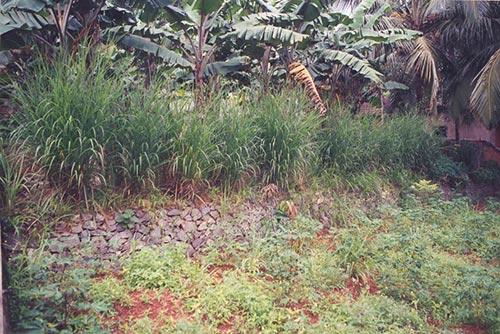
| Earthen Bunds |
|
|
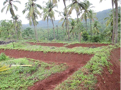 Bunds are small embankment type structures made up of locally available earth materials. Land slope and soil characteristics are considered for selection of bund type and design. Bunds help to check the velocity of the run-off, to carry excessive rainfall safely downstream and to let off stream flow in natural channels. Bunding increases the time of concentration of rainwater where it fall thereby allowing rainwater to percolate into the soil. Where ever possible agronomic conservation measures like agrostology, planting of grass specials etc are provided on the constructed bunds.
| Stone Pitched contour bunds |
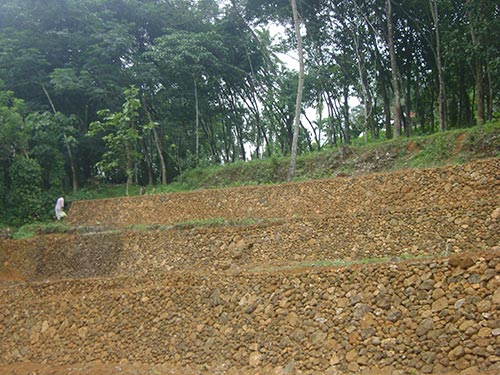 Stone Pitched contour bunds are constructed in contour at suitable intervals in slopes. The adoption of this intervention, has lead to reduction in soil erosion and increased water availability for crop plants. This type of construction is very suitable for laterite soil or wherever stone is available, up to 35% of slope areas can be protected by this way. Stone Pitched contour bunds are constructed in contour at suitable intervals in slopes. The adoption of this intervention, has lead to reduction in soil erosion and increased water availability for crop plants. This type of construction is very suitable for laterite soil or wherever stone is available, up to 35% of slope areas can be protected by this way. |
| Graded bunds |
| Graded bunds are adopted in areas having low infiltration (< 8 mm/hr) and more than 800 mm rainfall. Graded bunds are laid along pre-determined longitudinal grade instead of along the contours for safe disposal of excess runoff. Gradient given may vary from 0.4 t0 0.8%.(0.4 for light soils and 0.8 for heavy soils). |
| Vegetative Hedges |
| Runoff velocity can be reduced drastically by planting vegetative hedges, bunch grass, or shrubs on the contour at regular intervals .These hedges can increase the time for water to infiltrate into the soil and facilitate sedimentation and deposition of eroded material by reducing the carrying capacity of the overland flow. Vegetative hedges or narrow grass strips serve as porous filters. These hedges may not reduce runoff amount but can drastically decrease soil loss. |
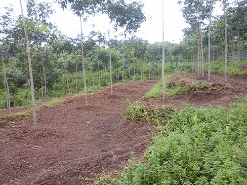
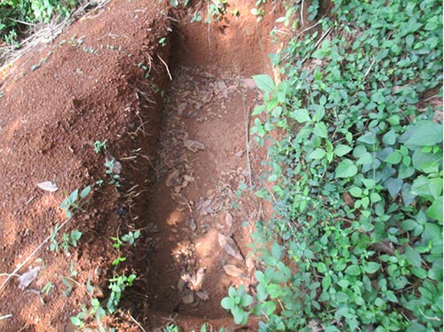
| Trenches |
|
Contour trenches are used both on hill slopes as well as on degraded and barren waste lands for soil and moisture conservation and afforestation purposes. The trenches break the slope and reduce the velocity of surface runoff. It can be used in all slopes irrespective of rainfall conditions (i.e., in both high and low rainfall conditions), varying soil types and depths. a) Contour trench Trenches are constructed as continuous across slope with 45-50 cm depth and bottom width and trapezoidal in shape b) Staggered r trench The length of trenches is kept short up to 2-3 m and are spacing is 5-7m. It is suited for medium rainfall areas with dissected topography. |
| Strip Terrace |
 It is used to control soil erosion in highly sloped areas. It basically involves construction of ridges and step like structures across land slope. Strip terrace are commonly adopted in area of rubber plantations in Kerala. It is used to control soil erosion in highly sloped areas. It basically involves construction of ridges and step like structures across land slope. Strip terrace are commonly adopted in area of rubber plantations in Kerala. |
| Moisture Conservation Pits |
 Any form of depression or micro pit is constructed over the land surface to arrest excess surface runoff and silting and thus leading to ground water recharge. Pits of suitable dimension are constructed in the field which would impound water and contribute o ground water recharge during rainy season. The silt accumulated in the pits could be dug out and used in the farmer’s field which would improve nutrient status of the soil. Any form of depression or micro pit is constructed over the land surface to arrest excess surface runoff and silting and thus leading to ground water recharge. Pits of suitable dimension are constructed in the field which would impound water and contribute o ground water recharge during rainy season. The silt accumulated in the pits could be dug out and used in the farmer’s field which would improve nutrient status of the soil. |
| Agrostological measures |
 Suitable grass species preferably fodder grass is planted in rows across the slope. It can also be planted on the berm of bunds .The fibrous root system of grass will offer better protection of the top soil and filter the run off to trap the sediments.. Well established grass species reduce erosion by moderating the impact of raindrops and also increases the infiltration opportunity time. The grass thus planted could be used as fodder for livestock, which could also be an alternate source of income to the farming community. Suitable grass species preferably fodder grass is planted in rows across the slope. It can also be planted on the berm of bunds .The fibrous root system of grass will offer better protection of the top soil and filter the run off to trap the sediments.. Well established grass species reduce erosion by moderating the impact of raindrops and also increases the infiltration opportunity time. The grass thus planted could be used as fodder for livestock, which could also be an alternate source of income to the farming community. |
| Agroforestry |
| Agroforestry measures proposed include planting of woody perennials (Trees, Bamboo, Shrubs etc) wherever necessary to control soil erosion. These measures reduce erosive force of water through impeding effects of tree roots and through soil cover provided by the tree canopy and litter. These are potential enough to conserve soil and moisture in the area through a combination of mulching and shading |
| II. Drainage Line Treatments |
|
Drainage channels/gullies are the carriers of runoff and sediment in watershed. Steep bed gradient (Slope) of a channel cause high runoff velocities with associated heavy sediment flow. Hence channel gradient needs to be reduced in order to being the runoff velocities within permissible limits. The Drainage Line treatments aim at betterment of the drainage lines and facilitate better local production environment of the concerned areas by providing the required basic infrastructure. Moderation of Floods and related damage, control of saline intrusion etc are the major areas which facilitate increased productivity. The Drainage Line treatments aim at betterment of the drainage lines and facilitate better local production environment of the concerned areas by providing the required basic infrastructure. Major items of works that can be taken up are given below. |
| Check Dams |
|
Loose boulder check dam is constructed using locally available stones and other materials across the stream to reduce runoff velocity and to entrap the sediments. Masonry check dams are constructed across streams of heavy flow and high velocity. The construction cost is usually high and requires hydrologic and hydraulic designs. Gabion check dams are very much suitable for degraded locations like high rainfall areas with torrential streams/drainage lines to stabilize. |
 Check dams are constructed across the stream flow to reduce the velocity of runoff water and to entrap the sediments..Check dams are built in a range of sizes using a variety of materials, including clay, stone and cement. Earthen check dams, or embankments, can easily be constructed by the farmers themselves. There are logwood Check Dams, loose boulder Check Dams, dryrubble check Dams and Concrete /masonry check Dams. Masonry and reinforced cement concrete (RCC) check Dams are of more permanent in nature and serve the purpose of water conservation. The sluice, spillways and other regulatory structures constructed in the drains help to regulate the flow of excess water.
| Stream Bank Stabilization |
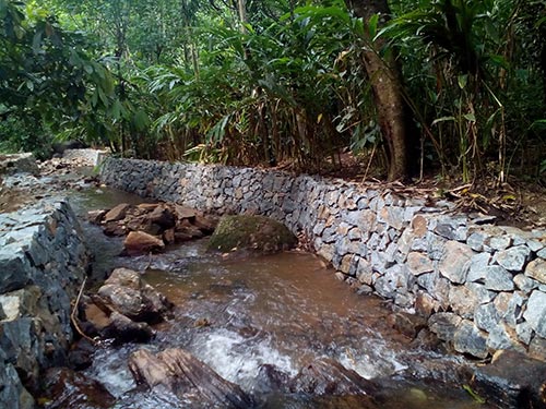 Due to undulating topography and high intensity of rainfall, huge quantities of rainwater flow through the drains. The existing drains are silted and flow of water through the drains is restricted resulting in severe bank erosion, overflow and spreading of water through adjacent agricultural land causing damage to crops. Stream bank stabilization is done by constructing retaining walls of different configurations and design.By stabilizing the stream banks, the flow can be regulated, scouring of banks avoided and drainage congestion can be averted. Due to undulating topography and high intensity of rainfall, huge quantities of rainwater flow through the drains. The existing drains are silted and flow of water through the drains is restricted resulting in severe bank erosion, overflow and spreading of water through adjacent agricultural land causing damage to crops. Stream bank stabilization is done by constructing retaining walls of different configurations and design.By stabilizing the stream banks, the flow can be regulated, scouring of banks avoided and drainage congestion can be averted. |
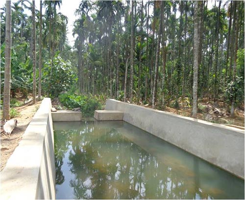
| Farm Ponds & Water Harvesting Structures |
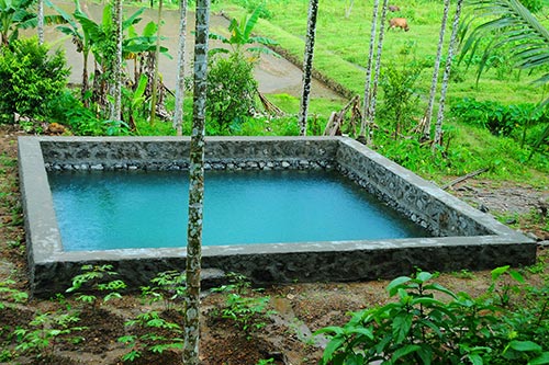 Farm Ponds are mainly meant for the purpose of storing the surface runoff. The farm ponds and water harvesting structures constructed in the low lying areas contributed to the conservation of excess rain water and the replenishment of ground water. The water harvesting structures are constructed as masonry structures. The impounded water also provides life saving irrigation to the lands in the ayacut. It will increase the soil moisture regime around the structure for increased crop production and recharge the ground water. Farm Ponds are mainly meant for the purpose of storing the surface runoff. The farm ponds and water harvesting structures constructed in the low lying areas contributed to the conservation of excess rain water and the replenishment of ground water. The water harvesting structures are constructed as masonry structures. The impounded water also provides life saving irrigation to the lands in the ayacut. It will increase the soil moisture regime around the structure for increased crop production and recharge the ground water. |
| Coir Geo textiles |
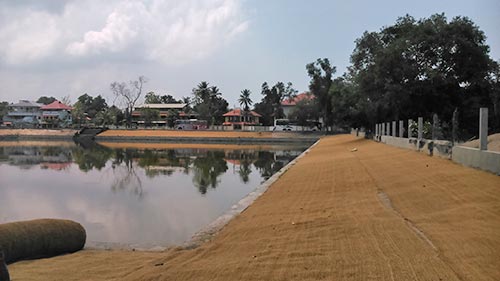 Coir geo-textiles is used as an erosion control measures for lake, canal and river bank protection. Coir mesh–mattings are used extensively in erosion control works. The ultimate objective is to establish a dense network of root system and vegetative cover to the desired degree of growth in the shortest possible time. Coir geo textiles intercept rainfall and aid in insitu moisture conservation. Coir geo-textiles is used as an erosion control measures for lake, canal and river bank protection. Coir mesh–mattings are used extensively in erosion control works. The ultimate objective is to establish a dense network of root system and vegetative cover to the desired degree of growth in the shortest possible time. Coir geo textiles intercept rainfall and aid in insitu moisture conservation. |
| Percolation Ponds |
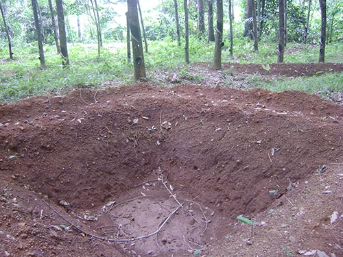 Percolation tanks are small water harvesting structures constructed across natural stream or water course to artificially recharge ground water during lean months. These structures increase the availability of water in the wells of surrounding area even during dry spells, which can be utilised by farmers for domestic as well as for irrigation purposes .They are constructed across nalas for checking velocity of run off for increasing water percolation, improving soil moisture and promote siltation. Pineapple or guinea grass could be planted on the berm of the pond which will apart from providing better reinforcement; provide additional income by way of fodder /fruit. During the dry seasons, the ponds could be put to alternate use by dumping organic wastes which can be used as manure before the onset of monsoon. Percolation tanks are small water harvesting structures constructed across natural stream or water course to artificially recharge ground water during lean months. These structures increase the availability of water in the wells of surrounding area even during dry spells, which can be utilised by farmers for domestic as well as for irrigation purposes .They are constructed across nalas for checking velocity of run off for increasing water percolation, improving soil moisture and promote siltation. Pineapple or guinea grass could be planted on the berm of the pond which will apart from providing better reinforcement; provide additional income by way of fodder /fruit. During the dry seasons, the ponds could be put to alternate use by dumping organic wastes which can be used as manure before the onset of monsoon. |
| Spring water development/Aquifer Protection |
| Springs could be artesian, gravity or seepage type. As contamination is the major threat as far as spring water source is concerned, steps should be taken to prevent contaminants from flowing to the spring source. Starting at the highest point(s) at which there is evidence of spring water issuing from the soil, excavate narrow trenches uphill following the direction from which most of the water is flowing. Trench should be about 1.m. deep if sufficient water is flowing into the end of the trench from the ‘eye’ of the spring. Stone filled trenches and pipes are laid to convey water from the protected source. Required side walls, wing walls and aprons are proposed to maintain steady flow from the springs and to aid in better utilization of water. The springs thus rejuvenated is protected further by construction of diversion ditches and fences to prevent polluted surface water from flowing through the fence onto the site of the spring. |
| Well recharge |
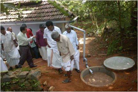 Open dug wells are used as source of drinking water in majority of households. But due to improper water management, majority wells do not have sufficient water to cater to the minimal domestic requirements of a household. Some of the public wells have become unusable due to dumping of waste. Collection of rain water from roof top of households and diverting the same to wells after proper filtration will be resorted to recharge wells. Further water recharge through construction of pits near the vicinity of wells would also aid in increased Open dug wells are used as source of drinking water in majority of households. But due to improper water management, majority wells do not have sufficient water to cater to the minimal domestic requirements of a household. Some of the public wells have become unusable due to dumping of waste. Collection of rain water from roof top of households and diverting the same to wells after proper filtration will be resorted to recharge wells. Further water recharge through construction of pits near the vicinity of wells would also aid in increased |


